Nairobi National Park Management, Governance and Zones
tags) into a second Custom HTML block,
placed AFTER the HTML content block (File 1) on the same page.
In Gutenberg:
1. Click the "+" to add a new block BELOW your content block
2. Choose "Custom HTML"
3. Paste this entire file —
NairobiPark.org · Hub Guide
Nairobi National Park Management, Governance & Zones
The authoritative guide to how Kenya's first national park is governed, planned, zoned and operated — covering KWS authority, the 2020–2030 Management Plan, the six-zone zonation scheme, entry gates, park markers and all stakeholder bodies.
Kenya Wildlife ServiceManagement Plan 2020–20306-Zone Zonation Scheme5 Management Programmes6 Entry GatesEstablished 1946
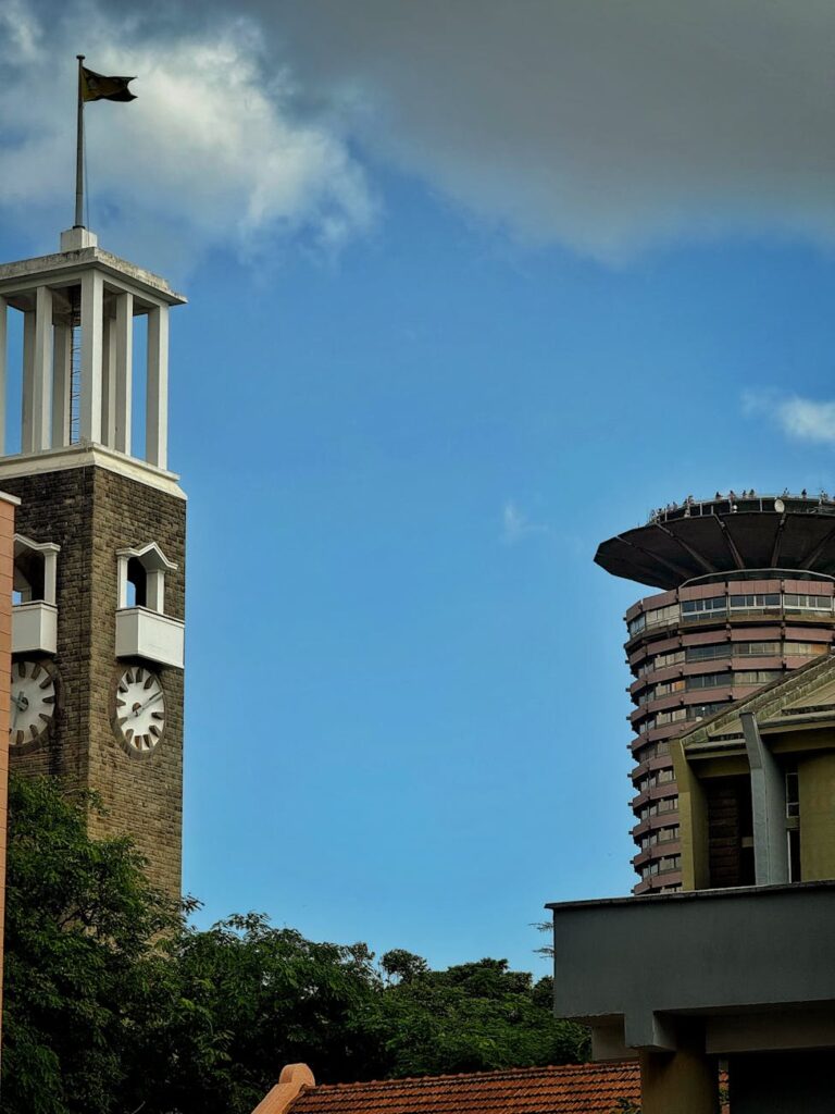
📷 SWAP IMAGE 1 — NNP aerial / KWS HQ main gate / park overview (1200×500px)
Nairobi National Park — 117 km² of protected savannah, forest and riverine habitat 7 km south of Kenya's capital, managed by Kenya Wildlife Service under the Wildlife Conservation and Management Act 2013. Replace with your own NNP image.
Nairobi National Park is the world's only national park situated within a capital city — and its governance reflects that unique challenge. Managing a live ecosystem bordered by Nairobi's expanding urban footprint, industrial zones, major roads and an international airport requires a sophistication of planning and institutional capacity that few protected areas anywhere in the world match. This hub guide covers everything about how the park is governed and managed: the legal framework, KWS's operational role, the five management programmes of the 2020–2030 Management Plan, the six-zone zonation scheme, the entry gates and park markers, and the full network of stakeholders who shape its future.
⚖️
01 · Legal Status & Founding
Gazetted
16 Dec 1946
Proclamation No. 48 — Kenya's first national park
Area
117.21 km²
Boundary plan No. 204/1; Nairobi County
Legal framework
WCMA 2013
Wildlife Conservation & Management Act 2013
Governing body
KWS
Kenya Wildlife Service — statutory mandate
Nairobi National Park was gazetted on 16 December 1946 by Proclamation No. 48 — making it Kenya's first national park, established two years before Tsavo (1948). It was created under the colonial-era National Parks Ordinance, with boundaries delineated in plan No. 204/1. Today the park is legally protected under Kenya's Wildlife Conservation and Management Act (WCMA) 2013, which provides the statutory framework for the declaration, boundary protection, prohibited activities and enforcement mandate within national parks.
The park is the only protected part of the Athi-Kapiti ecosystem, covering less than 10% of this wider ecological unit. This means Nairobi National Park's legal boundary is not ecologically sufficient on its own — the management framework must extend beyond the fence line to the dispersal lands to the south. This legal-ecological tension is at the heart of every major governance challenge the park faces.
The park is administratively located in Nairobi County and sits approximately 7–10 km south of Nairobi's city centre. Its northern, eastern and western boundaries are delineated by an electric fence. The southern boundary, formed by the Mbagathi River, is legally open to allow wildlife dispersal into the Kitengela Conservation Area and Athi-Kapiti plains — a deliberate design choice in the founding boundary plan that remains central to the park's ecological functioning.
🏛️
02 · KWS Governance Structure
📷 SWAP IMAGE 2 — KWS Headquarters gate / NNP main gate sign / ranger on patrol (800×380px)
The Main Gate on Langata Road doubles as the KWS Headquarters for Nairobi National Park — the administrative nerve centre for ranger operations, visitor management and law enforcement. Replace with your own image.
Kenya Wildlife Service (KWS) holds the primary statutory mandate for managing Nairobi National Park. Established under the Wildlife Act and operating as a state corporation, KWS is responsible for wildlife conservation, law enforcement, visitor management, ecological monitoring, anti-poaching operations and all infrastructure within the park boundary. The NNP Main Gate on Langata Road is simultaneously the park's primary visitor entrance and the location of KWS Headquarters.
KWS operational responsibilities at NNP
01
Ranger operations & law enforcement
24-hour patrol sectors covering all habitats; anti-poaching intelligence units; rhino protection team of 79 rangers operating across 25 monitoring blocks under continuous surveillance.
02
Wildlife monitoring & species management
Species census, biomass tracking, giraffe counts and habitat assessment — delegated in part to WRTI (Wildlife Research and Training Institute). CITES compliance coordination for global trade regulation.
03
Visitor management & revenue
Entry fee collection, gate operations, picnic site maintenance, road network management. NNP is one of Kenya's top five revenue-generating parks, contributing to system-wide KWS funding.
04
Human-wildlife conflict response
Rapid response to wildlife incidents in adjacent urban areas; fence monitoring and repair; coordination with Nairobi County on conflict cases near park boundaries.
05
Infrastructure & road network
Maintenance of 287 km of internal roads; management of natural and artificial water points (dams); maintenance of picnic sites, gates and visitor facilities.
06
Ecological management
Habitat management, fire management (prescribed burning in General Use Zones), water point management, invasive species control and environmental impact oversight.
Unlike remote parks, Nairobi National Park operates under exceptionally high management costs due to fencing, urban-edge security, road maintenance, ranger deployment and human-wildlife conflict prevention. Its revenue model depends primarily on visitor fees — making it structurally dependent on maintaining a strong visitor proposition while simultaneously protecting ecological integrity. This tension is a defining feature of NNP governance.
📋
03 · Management Plan 2020–2030
The Nairobi National Park Management Plan 2020–2030 is a 176-page strategic planning document prepared by KWS in consultation with a broad cross-section of park stakeholders. It is not an entirely new plan — it builds on the previous NNP Management Plan (2005–2010), carrying forward proven policy direction while incorporating new content on visitor experience, community benefits and ecological resilience. The plan is structured according to the KWS Protected Areas Planning Framework (PAPF) and is aligned with the KWS Strategic Plan 2019–2024.
The 2020–2030 Management Plan governs all management decisions including road use, infrastructure, zone designations and ecological interventions. Replace with a planning/management photo.
The plan is the authoritative document governing what can and cannot happen inside Nairobi National Park. Any development, infrastructure project, activity or change in management practice must be assessed against this plan's prescriptions. Zone designations, management objectives and activity rules all derive from it. Access the full 176-page Management Plan PDF on NairobiPark.org →
Plan structure overview
Part 1 — Introduction and park overview
Sets out the plan's functions, structure and stakeholder participation mechanisms. Introduces NNP's location, exceptional resource values and Purpose Statement — the formal declaration of why the park exists as a protected area. Covers the major management issues and the four management options considered, leading to the selection of Option 4 (integrated land use management in buffer zones and dispersal areas).
Part 2 — Zonation scheme
Sets out the six zones of the park, with prescriptions on the types of visitor use, tourism developments and infrastructure permitted in each zone. This is the regulatory core of the plan and the section most frequently cited in governance disputes. See the full zone breakdown in Section 05 of this guide.
Part 3 — Five management programmes
The operational bulk of the plan, divided into five management programmes: (1) ecological integrity, (2) visitor experience and revenue, (3) community benefits and human-wildlife conflict, (4) wildlife security, and (5) institutional effectiveness. Each programme contains objectives, prescriptions and specific management actions with assigned responsibilities and timeframes.
Part 4 — Implementation and monitoring
Sets out the implementation schedule, budget framework, monitoring indicators and reporting mechanisms. Identifies which NNP management sections and KWS HQ departments are responsible for each action. The plan is designed as a practical management tool, not a policy statement — it is intended to be used daily by park managers.
Participatory planning process
The management plan was developed through a participatory process involving NNP managers, KWS HQ departments, and a wide range of stakeholders. KWS and the Conservation Alliance of Kenya organised public webinars and consultation meetings during the drafting process. A formal "Stakeholder Feedback Report on the Nairobi National Park Draft Management Plan" was produced before finalisation. The plan explicitly acknowledges that KWS has no jurisdiction over land use outside the park boundary — making stakeholder cooperation with Kitengela landowners and conservation partners essential to achieving management objectives.
🎯
04 · The Five Management Programmes
The 2020–2030 Management Plan organises all management actions into five overarching programmes. Each programme has defined objectives, prescriptions and actions aligned to the park's overall purpose statement. Together they cover every aspect of park management from ecological monitoring to visitor experience to community relations.
P1
Ecological Integrity Programme
Habitat management, vegetation monitoring, invasive species control, fire management, water point management, and biodiversity monitoring. Addresses climate-related risks and ensures the park's ecosystem functions are maintained. The highland dry forest, grasslands, riverine corridors and wetlands each have specific management prescriptions.
P2
Visitor Experience & Revenue Programme
Road network maintenance, visitor facilities, picnic sites, interpretation services, tour operator management, and revenue optimisation. Responsible for maintaining the visitor proposition that generates the park's income — a critical function given the park's operational cost pressures.
P3
Community Benefits & HWC Programme
Human-wildlife conflict (HWC) response, community liaison, Wildlife Conservation Lease Programme, corridor conservation, and benefit-sharing with communities in the Kitengela dispersal area. Includes support for initiatives like Lion Lights that reduce retaliatory killings.
P4
Wildlife Security Programme
Anti-poaching operations, ranger patrol deployment, fence monitoring and repair, intelligence gathering, law enforcement, and species-specific protection (notably the 79-ranger rhino protection unit). Covers CITES compliance and coordination with national law enforcement.
P5
Institutional Effectiveness Programme
KWS staff capacity, operational budgeting, financial management, stakeholder engagement, monitoring and reporting, and management plan review. Ensures the park management system functions effectively and adapts to emerging challenges over the plan period to 2030.
The five management programmes collectively address four clusters of threats identified in the plan: threats to wildlife populations, threats to habitat quality, threats to visitor experience and revenue, and threats to the governance and institutional framework. Each programme's objectives are designed to counter specific threat clusters rather than being siloed activities.
🗺️
05 · Six-Zone Zonation Scheme
The zonation scheme is the most legally significant and frequently cited part of the Management Plan. It divides the park into six zones, each with specific prescriptions on the types of visitor use, infrastructure and management interventions permitted. The scheme has the force of planning policy — any development or activity within the park must be assessed for consistency with the relevant zone's prescriptions. It is the document at the centre of every major conservation dispute about park development.
📷 SWAP IMAGE 4 — NNP zonation map / KWS official zone map graphic (900×480px) — ideal to create a custom zone map with the six zones colour-coded
The six management zones of Nairobi National Park as defined in the 2020–2030 Management Plan. Recommended: commission or create a custom colour-coded zone map using the official KWS zone boundaries for this image slot. Current image: placeholder NNP base map.
The zonation scheme contains prescriptions that are genuinely binding on management decisions. Activities not permitted in a zone cannot be authorised regardless of other approvals. This makes the zone designation — and any attempt to change it — a high-stakes governance issue, as demonstrated by the 2025–2026 controversy over the Nairobi Animal Orphanage relocation project in the Low-Use Zone.
The six zones explained
Zone 1
Wilderness Zone (WZ)
The highest level of protection within the park. Covers the most ecologically sensitive areas with the least human disturbance. Visitor access is strictly limited; no infrastructure is permitted; management interventions are minimal and only for conservation purposes. This zone is managed primarily for biodiversity and natural processes.
✓ Wildlife monitoring✓ Research (permitted)✗ No new infrastructure✗ No off-road driving✗ No development
Zone 2
Low-Use Zone (LUZ)
Encompasses the scenic Highland Dry Forest / Kisembe Forest in the western uplands and the southern forest sections. Designated for minimal human intervention with very strict activity guidelines. Designed to give visitors a sense of solitude and protect sensitive forest habitats. This zone has been at the centre of the 2025–26 conservation controversy over the planned Nairobi Animal Orphanage relocation.
✓ Walking trails (ranger-led)✓ Quiet game viewing✗ No new roads✗ No infrastructure✗ No off-road driving✗ No prescribed burning
Zone 3
General Use Zone (GUZ)
Covers the majority of the park's open grassland and savannah areas — the core game-viewing terrain. Standard game drives, picnic sites and existing road network use are all permitted. Ecological management interventions such as prescribed burning are conducted in this zone. The bulk of visitor time in the park is spent in the General Use Zone.
✓ Game drives (roads)✓ Picnic sites✓ Prescribed burning✓ Water point management✗ No permanent lodges
Zone 4
Intensive Use Zone (IUZ)
The highest-activity visitor zone, covering the areas immediately around the main gate, the Nairobi Safari Walk, the Animal Orphanage and associated visitor facilities. Infrastructure development for visitor services is permitted. This zone is designed to concentrate intensive visitor use and its associated impacts in a defined area, protecting the rest of the park from over-development.
Designated areas where specific public infrastructure or utility installations are permitted within the park boundary. This zone has been the subject of significant debate among conservationists and the general public, with FoNNaP and others warning that the special use zone designation could legitimise infrastructure developments that fragment critical habitat. KWS maintains that the zone is necessary for the park to function within a capital city context.
✓ Public infrastructure✓ Utility installations✗ Subject to EIA✗ Contested by FoNNaP
Zone 6
Buffer Zone / Southern Dispersal Corridor
The open southern boundary along the Mbagathi River and the land beyond into the Kitengela Conservation Area. Not fenced. KWS has no jurisdiction over land use in this zone outside the park boundary, making it dependent on voluntary conservation agreements with willing landowners. The Wildlife Conservation Lease Programme attempts to incentivise landowners to maintain this corridor open for wildlife dispersal. Its integrity is the park's most critical and threatened ecological asset.
The Low-Use Zone corresponds to the Highland Dry Forest / Kisembe Forest — the park's most sensitive and biodiverse habitat zone. Our companion guide covers the ecology, bird species, canopy trees, leopard habitat and birding trails of this zone in full detail.
Nairobi National Park has six entry gates positioned around its boundary to serve visitors coming from different parts of Nairobi and beyond. Gate choice affects which part of the park you enter first, the facilities available, and the practical logistics of your visit. The gates are managed by KWS; entry fees are payable by Mpesa or card.
Main Gate, Langata Road — KWS HQ. Most popular and best-equipped entrance. Replace.
📷 SWAP IMAGE 5b — East Gate / Banda Gate near Mombasa Road (500×330px)
East Gate / Banda Gate — best entry point from JKIA (15–25 min). Replace.
Primary gate
Main Gate (Langata Road)
Located on Langata Road, 7 km from Nairobi CBD. Also known as the KWS Headquarters Gate. The most popular and best-equipped entrance with ticket offices, information centre, parking, toilets, and proximity to the Nairobi Safari Walk and Animal Orphanage.
Located on the northeastern side of the park near Mombasa Road and the Standard Gauge Railway (SGR). Approximately 9.8 km from JKIA (15–25 min). The best gate for airport transfers and visitors arriving by or departing on Mombasa Road.
Best for: JKIA airport transfers, visitors from Mombasa Road hotels.
Gate
Langata Gate (Langata South Road)
Situated on the southern boundary, accessed from Langata South Road. Adjacent to Galleria Shopping Mall. Provides entry to the western plains, offering iconic views of wildlife against the Nairobi skyline. Good for Karen and Langata residents.
Best for: Karen / Langata residents, western plains circuit, avoiding main gate traffic.
Gate
Mbagathi Gate (SW boundary)
Located on the southwestern side of the park along Magadi Road. Originally a KWS Workshop / service gate, formally opened to the public on 23 November 2021. Less busy than the Main Gate; limited facilities. Also known historically as Cheetah Gate.
Best for: Visitors from Magadi Road direction, quieter entry, southern park circuit.
Gate
Masai Gate
Located on the southern boundary with access from the Magadi Road direction. Provides access to the southern plains — the "wildest" and least-visited section of the park, often the best area for rhino, cheetah and open-country views.
The Hippo Pools area near Masai Gate provides access to the 2.5 km walking trail along the Mbagathi River — one of only two on-foot wildlife experiences in the park. Entry through adjacent southern gates; coordinate with the ranger desk for walking arrangements.
Best for: Walking trail, Mbagathi River birding, hippo and crocodile viewing.
Nairobi National Park's 287 km of internal roads connect a network of named stops, landmarks, picnic sites, dam viewpoints and conservation monuments. These markers serve multiple functions: they are navigation anchors for self-drive visitors, designated stops for guided tours, rest points for walking trails, and historically significant sites in Kenya's conservation story. Knowing the key markers is essential to planning an efficient and rewarding visit.
📷 SWAP IMAGE 6 — Ivory Burning Site monument / Hyena Dam / Leopard Cliff (800×380px)
The contrast between wildlife and city skyline is NNP's most iconic visual — experienced best from the western plains near the Langata Gate entry corridor. Replace with an Ivory Burning Site, Hyena Dam or Leopard Cliff photo.
Conservation monuments
🔥
Ivory Burning Site
Central / near Nagolomon Dam
One of the most significant conservation landmarks in Africa. In 1989, President Daniel arap Moi burned 12 tonnes of ivory here, sending a global signal against the illegal ivory trade. A second, larger burning of 105 tonnes took place in 2016. The site is now an open monument with educational signage and is a standard stop on conservation-focused tours.
A memorial within the KWS Headquarters compound honouring KWS rangers killed in the line of duty protecting Kenya's wildlife. A sobering and important stop that contextualises the human cost of anti-poaching operations. Located near the Main Gate before or after a park visit.
Water points & dam viewpoints
💧
Hyena Dam
Central park
One of the park's most reliable wildlife hotspots year-round. During the dry season, large numbers of animals concentrate here including buffalo, zebra, giraffe and (seasonally) hippos. Predators including lions and hyenas are regularly encountered nearby. Excellent for photography and birdwatching — pelicans, cormorants and various herons use the dam.
💧
Nagolomon Dam
Central / near Ivory Burning Site
A key water source in the central park, adjacent to the Ivory Burning Site. Important for large ungulates and their predators. The surrounding grasslands are productive for raptors. Often visited as part of the main game-viewing loop circuit.
💧
Athi Basin Dam
Southern sector
Located in the southern part of the park, connected to the Athi River system. Surrounded by open grassland plains offering excellent large-mammal viewing. The most remote of the main dams, accessed via the southern plains circuit — this is the area for encounters with rhino, cheetah and open-country species.
Viewpoints & scenic stops
🦏
Leopard Cliff / Mokoyiet Cliff
Mbagathi River gorge
A spectacular viewpoint overlooking the Mbagathi River gorge and surrounding plains. One of the best spots for encountering leopards resting in rocky outcrops or at the forest edge. Also productive for the shy African Finfoot on the river below, Martial Eagle and rock hyrax. Dramatic scenery with panoramic views across the plains.
🦜
Kingfisher Picnic Site
Elevated, mid-park
An elevated picnic site with sweeping panoramic views — among the best vantage points in the park for scanning the plains. Named for the kingfisher species that frequent nearby water. Popular for birding and sundowner stops. Facilities include picnic tables and toilets.
🦛
Hippo Pools (Mbagathi River)
Southern boundary / Masai Gate area
A 2.5 km walking trail along the Mbagathi River to a viewing platform where hippos can be observed alongside Nile crocodiles, herons, egrets, African Finfoot and Malachite Kingfisher. One of only two on-foot wildlife experiences in the park. A KWS ranger escort is required — arrange at the gate on arrival.
A designated viewpoint close to the central safari circuits, well-placed for observing impala, zebra, gazelle and occasional buffalo on the open grassland. One of the park's seven official picnic sites with tables, permanent toilets and frequent ranger patrols. Close proximity to the Main Gate makes it a convenient first or last stop.
🌄
Mokoyiet / Mokoiyet Picnic Site
Clifftop, mid-park
Perched on a cliff with panoramic views across the plains and Mbagathi River valley. One of the quieter and more scenic picnic locations, excellent for photography and game spotting from an elevated position. Particularly rewarding in late afternoon light.
🌿
Corner Baridi / Kisembe Forest Trail
Western uplands forest circuit
The gateway stop to the Highland Dry Forest section, known as "the cold bend." This is the entry point for the on-foot forest trail through the Afromontane canopy — the best access to forest birds including Hartlaub's Turaco, African Crowned Eagle, Narina Trogon and Silvery-cheeked Hornbill. Walking permitted with ranger escort.
A raised boardwalk and interpretive centre just outside the Main Gate, showcasing rescued and rehabilitated animals in naturalistic enclosures. An excellent family destination and introduction to Kenya's biodiversity. Operated by KWS; separate entry fee from the main park.
🐘
David Sheldrick Wildlife Trust
Within Main Gate compound
The elephant orphanage operated by the Sheldrick Wildlife Trust — one of the most successful elephant rescue and rehabilitation programmes in the world. Open to visitors during specific morning hours (typically 11:00 AM). Separate visit arrangement required. Strongly linked to Kenya's anti-poaching and conservation identity.
🦓
Animal Orphanage
Main Gate compound
Established in 1964 as a centre for the rescue, rehabilitation and care of injured or orphaned wildlife. Currently at the centre of a controversy (2025–26) over KWS's proposed relocation and expansion of the facility into an area classified as Low-Use Zone under the Management Plan.
Nairobi National Park's governance extends well beyond KWS. A network of civil society organisations, research bodies, international conservation groups, community associations and government entities all play roles in the park's management, advocacy or ecosystem support. Understanding who these stakeholders are — and what their roles are — is essential to understanding the park's governance dynamics.
The park's governance involves a broad coalition of stakeholders — from KWS rangers to civil society groups, research institutions and community conservancies south of the boundary. Replace with your own stakeholder/community photo.
Kenya Wildlife Service (KWS)
Primary statutory manager. Legal mandate for wildlife conservation, law enforcement, protected area administration and visitor management. Coordinates with WRTI for research; with CITES for global trade regulation; with Nairobi County on HWC incidents.
Friends of Nairobi National Park (FoNNaP)
Non-profit membership society founded in 1995. The park's most active civil society watchdog. Engages with KWS and government bodies, advocates for the dispersal corridor, supports conservation education, and has been the leading voice in the 2025–26 Bomas/Animal Orphanage controversy. fonnap.org
Wildlife Research & Training Institute (WRTI)
KWS-affiliated research body responsible for wildlife census, biomass tracking, species monitoring and ecological research. Provides the scientific data that informs management decisions. Conducts giraffe counts, predator surveys and habitat assessments.
Conservation Alliance of Kenya
Co-organised the public webinars for the Management Plan consultation process with KWS. Broader role in Kenya's conservation governance; facilitates multi-stakeholder dialogue on protected area management policy.
Athi-Kapiti Wildlife Conservancies Association (AKWCA)
Strengthens community-led conservation across the wider dispersal landscape south of the park. Critical to maintaining the open corridor that NNP's ecological functioning depends on. Works with landowners in Kitengela, Isinya and Kapiti to maintain wildlife-compatible land use.
David Sheldrick Wildlife Trust
Operates the elephant orphanage within the Main Gate compound. Strongly associated with Kenya's anti-poaching narrative. Hosted the 2016 ivory burn. While not a management body, its presence and advocacy strengthen the park's conservation profile and public support base.
African Wildlife Foundation (AWF)
Has documented and supported incentive-based corridor approaches in the Nairobi ecosystem, including direct payment and lease models for landowners in the dispersal area south of the park.
Naretunoi Conservancy
A community conservancy in the park's southern dispersal landscape. Directly addressed in the Management Plan as part of the integrated land use strategy — KWS proposes negotiating with Naretunoi owners and the Ministry of Agriculture to manage the conservancy and park as a single ecological unit.
Kenya Parliament
Has formally received petitions from citizens regarding encroachment into the park — demonstrating that park governance extends to the legislative branch. Parliamentary oversight has been used as a tool to challenge management decisions inconsistent with the gazetted park boundary and management plan.
NNP's survival is not only about what happens inside the fence — it depends on the wider dispersal ecosystem and the governance decisions of multiple bodies with overlapping and sometimes conflicting mandates. The Management Plan is explicit that KWS cannot achieve its objectives alone and requires active cooperation from landowners, conservancies, community groups and government agencies across the Athi-Kapiti ecosystem.
⚠️
09 · Governance Challenges & Current Issues
Nairobi National Park faces governance challenges that are structural, ongoing and in some cases worsening. They reflect the fundamental tension of managing a wild ecosystem inside a capital city — where competing demands on land, infrastructure and public resources constantly press against conservation objectives.
The southern dispersal corridor — the existential governance issue
The open southern boundary is the park's most critical ecological asset and its most vulnerable governance challenge. KWS has no jurisdiction over land use outside the park fence, meaning the corridor's integrity depends entirely on voluntary conservation arrangements with landowners in Kitengela and the Athi-Kapiti plains. The Wildlife Conservation Lease Programme attempts to maintain open land through financial incentives, but urban expansion, land subdivision and fencing continue to fragment the corridor year by year. The Management Plan identifies this as the park's primary structural long-term risk.
The 2025–26 Bomas / Animal Orphanage controversy
In 2025–26, a major governance controversy erupted over KWS's proposed relocation and expansion of the Nairobi Animal Orphanage into an area designated as Low-Use Zone in the Management Plan. The project — linked to the Bomas International Convention Centre (BICC) development — included a large parking facility for 1,300 vehicles and a pedestrian overpass across Langata Road. FoNNaP and allied conservation groups argued the development violated the Management Plan's zone prescriptions and would destroy habitat for lions, rhinos, Maasai giraffes and endangered bird species. KWS maintained the project followed all legal procedures and was aimed at improving conservation services. As of 2026, the controversy remains unresolved.
Infrastructure fragmentation — roads, SGR and urban encroachment
The Southern Bypass, the Standard Gauge Railway (SGR), and ongoing urban development on the park's northern and eastern edges have progressively fragmented the landscape around the park. KWS has publicly acknowledged contributing to these challenges by permitting mega-projects inside and on the periphery of the park. The 287 km internal road network itself is cited by FoNNaP as excessive — though KWS maintains it as essential for management and visitor operations.
Revenue dependency and conservation funding
Nairobi National Park is one of Kenya's top five revenue-generating parks and contributes significantly to system-wide KWS funding. This creates a structural dependency on maintaining visitor numbers that can conflict with conservation-first management decisions. The COVID-19 pandemic demonstrated the fragility of tourism-dependent conservation financing when KWS faced severe revenue shortfalls as international tourism collapsed. Carbon credit markets and alternative financing mechanisms are being explored by KWS as supplementary income streams.
Special Use Zone debate
The Special Use Zone (Zone 5) designation — which allows public infrastructure within the park boundary — has been controversial since the Management Plan was published. Conservationists and FoNNaP warn that the zone designation legitimises infrastructure development that fragments habitat. KWS argues the zone is necessary for the park to function within its urban capital city context. The tension between these positions is a recurring fault line in NNP governance.
The Management Plan itself notes that management Option 4 — the selected approach — "acknowledges the service has no jurisdiction on land and land use outside the park and, hence, it is imperative that it first concentrates its efforts on the conservation and protection of biodiversity within the park boundary" while pursuing negotiated conservation arrangements outside it. This honest acknowledgement of KWS's limited reach is one of the most important sentences in the entire governance framework.
📅
10 · Management History Timeline
46
1946 — Gazetted as Kenya's first national park
Proclamation No. 48, 16 December 1946. Established under the colonial National Parks Ordinance. Boundary plan No. 204/1 defines the 117 km² area. Peter Cowie is credited as the first warden.
64
1964 — Animal Orphanage established
The Nairobi Animal Orphanage opens within the Main Gate compound as a centre for rescue and rehabilitation of injured or orphaned wildlife. It would operate there for over 60 years before the 2025–26 relocation controversy.
89
1989 — First ivory burn
President Daniel arap Moi burns 12 tonnes of ivory at what becomes the Ivory Burning Site. The act sends a global signal about Kenya's stance against poaching and contributes to the international CITES decision to ban the ivory trade.
95
1995 — FoNNaP founded
Friends of Nairobi National Park established as Kenya's first dedicated urban park advocacy society, providing civil society oversight of park governance and management decisions.
05
2005–2010 — First formal management plan
The NNP Management Plan 2005–2010 is produced — the first structured planning document for the park. It establishes the policy direction on ecological integrity that the 2020–2030 plan would later carry forward and build upon.
13
2013 — Wildlife Conservation & Management Act
The WCMA 2013 replaces the Wildlife Act and provides the current statutory framework for NNP's protection, KWS's management mandate and enforcement powers.
16
2016 — Second ivory burn (105 tonnes)
President Uhuru Kenyatta burns 105 tonnes of ivory and 1.35 tonnes of rhino horn at Nairobi National Park — the largest such destruction in history at the time. The event reinforces Kenya's global conservation leadership identity.
20
2020 — Management Plan 2020–2030 adopted
After a participatory consultation process involving managers, stakeholders and public webinars, the KWS Management Plan 2020–2030 is finalised. It introduces the six-zone zonation scheme and five management programmes that govern the park for the current decade.
21
2021 — Mbagathi Gate opened to the public
On 23 November 2021, KWS formally opens Mbagathi Gate (previously a restricted KWS workshop/service gate) to public visitors, expanding access to the southwestern part of the park.
25
2025–26 — Bomas / Animal Orphanage controversy
A major governance dispute erupts over KWS's proposed Animal Orphanage relocation into the Low-Use Zone. FoNNaP and allied groups argue the project violates zone prescriptions; KWS maintains it has followed all legal procedures. The dispute highlights ongoing tensions over the Special Use Zone designation and development pressure on the park's most sensitive habitats.
🔗
11 · Related Guides on NairobiPark.org
This page is the hub for park management and governance. All related zone, habitat, wildlife, visitor and conservation guides on NairobiPark.org are linked below — organised by topic.
Nairobi National Park is managed by Kenya Wildlife Service (KWS), the statutory body with the legal mandate for wildlife conservation, protected area administration and law enforcement in Kenya under the Wildlife Conservation and Management Act 2013. The Wildlife Research and Training Institute (WRTI) assists with research and biomass tracking. Day-to-day operations including ranger patrols, visitor management, gate operations and ecological monitoring are all KWS functions based at the park's Main Gate / KWS Headquarters on Langata Road.
How many zones does Nairobi National Park have?
According to the Nairobi National Park Management Plan 2020–2030, the park is divided into six management zones: Zone 1 (Wilderness Zone), Zone 2 (Low-Use Zone — includes the Highland Dry Forest), Zone 3 (General Use Zone — the main game-viewing plains), Zone 4 (Intensive Use Zone — main gate and visitor facilities), Zone 5 (Special Use Zone — public infrastructure areas), and Zone 6 (Buffer Zone / Southern Dispersal Corridor). Each zone has specific prescriptions on permitted activities and infrastructure.
What is the Nairobi National Park Management Plan?
The Nairobi National Park Management Plan 2020–2030 is a 176-page strategic planning document produced by KWS through a participatory stakeholder process. It sets out the park's Purpose Statement, five management programmes (ecological integrity, visitor experience, community benefits, wildlife security, and institutional effectiveness), the six-zone zonation scheme, and specific management actions for the decade 2020–2030. It is the authoritative document governing what can and cannot happen inside the park boundary. The full PDF is available at nairobipark.org/nairobi-national-park-management-plan/
What is the low-use zone in Nairobi National Park?
The Low-Use Zone (LUZ — Zone 2) encompasses the scenic Highland Dry Forest (Kisembe Forest) in the western uplands and the southern forest sections. It is designated for minimal human intervention with strict guidelines: no new roads or infrastructure, no off-road driving, no prescribed burning and very little disturbance. Its purpose is to protect critical wildlife habitat — including leopard, black and white rhino, Maasai giraffe, African Crowned Eagle and Hartlaub's Turaco — while giving visitors a sense of solitude and forest scenery. Walking trails with ranger escort are permitted.
What is FoNNaP and what role does it play?
FoNNaP stands for Friends of Nairobi National Park. Founded in 1995, it is a non-profit membership society registered under the Societies Act of Kenya. FoNNaP is the park's most active civil society watchdog — it engages with KWS and government bodies, advocates for the park's southern dispersal corridor, supports conservation education, and monitors compliance with the Management Plan. It has been the leading voice in several major governance controversies including the 2025–26 Bomas/Animal Orphanage development dispute.
What is the Ivory Burning Site inside Nairobi National Park?
The Ivory Burning Site is a conservation monument inside Nairobi National Park where Kenya conducted two historic ivory burnings — 12 tonnes in 1989 under President Daniel arap Moi, and 105 tonnes in 2016 under President Uhuru Kenyatta (the largest single destruction of ivory in history at the time). The site is located near Nagolomon Dam in the central park and is open to visitors as an educational stop. It is one of the most significant conservation landmarks in Africa, symbolising Kenya's stance against the illegal ivory trade.
How many entry gates does Nairobi National Park have?
Nairobi National Park has six entry gates: the Main Gate on Langata Road (most popular, KWS HQ), East Gate / Banda Gate (near Mombasa Road, best for JKIA), Langata Gate (Langata South Road, near Galleria Mall), Mbagathi Gate (southwestern side, opened to the public November 2021), Masai Gate (Magadi Road direction, best for southern plains), and the Hippo Pools access near the Mbagathi River. The Main Gate is the most developed with the best facilities. For the full guide to all gates see nairobipark.org/6-gates-to-nairobi-n-park/
Sources & references:
KWS Nairobi National Park Management Plan 2020–2030 (kws.go.ke) ·
Friends of Nairobi National Park — FoNNaP (fonnap.org) ·
The Star: "Which way forward for Nairobi National Park?" (2020) ·
The Star: "Lobby sounds alarm over activity inside NNP" (March 2026) ·
East Leigh Voice: "Fresh row erupts over plan to take part of Nairobi park land" (March 2026) ·
Tourism Update: "Conservation row erupts over NNP development" (April 2026) ·
KEFRI / Development challenges and management strategies (academic paper) ·
nairobipark.org ecosystem, conservation, landmarks and facts guides ·
aberdarenationalparks.com / nairobinationalparkskenya.com / masaimara.ke — entry gate information ·
Huduma Global: Managing Kenya's National Parks (2026)