Nairobi National Park hydrology is a river–dam–wetland system built around the Mbagathi River, the Mokoyiet River, three major permanent dams, smaller seasonal dams, and a network of seasonal water pans. That water system matters because it shapes where wildlife concentrates, where wetland birds are easiest to find, how dry-season grazing pressure is distributed, and how ecologically resilient the park remains in a heavily urbanized landscape. In simple terms, Nairobi National Park is not just an open-plains safari park. It is also a managed water landscape.
The Nairobi National Park hydrology system is best understood through its named internal water features, especially Hyena Dam, Nagolomon Dam, and Athi Basin Dam. These sub-entities help explain how seasonal water, wetland condition, and drainage-linked habitats influence wildlife use inside Nairobi National Park.
This guide is about hydrology, not general visiting logistics. Its focus is how water works inside Nairobi National Park: what the main rivers and dams are, how they relate to habitats and wildlife, why smaller water points matter, and why hydrology has become one of the park’s most important conservation-management questions. If interested to learn how you can plan your visit to this Kenya’s urban Park, visit our Nairobi National Park visiting guide.
What Nairobi National Park hydrology includes
Nairobi National Park hydrology has four main components: rivers, major dams, seasonal dams, and seasonal water pans. Those components do not all function in the same way.
- Main rivers: the Mbagathi River and Mokoyiet River
- Major permanent dams: Hyena Dam, Nagolomon Dam, and Athi Basin Dam
- Seasonal dams: including Embakasi, Eland Hollow, Karen C. Primary, Olmanyi, Impala Point, Kingfisher, and Ruai
- Seasonal water pans: including No. 2, No. 6A, No. 24A, Banda, and No. 26D
This structure matters because different water features do different ecological work. Rivers create linear habitat corridors. Major dams function as high-value wetland nodes. Smaller dams and pans help spread water availability across the park and reduce overdependence on a few main sites.
Why hydrology matters in Nairobi National Park
Hydrology matters in Nairobi National Park because water determines wildlife concentration, wetland biodiversity, riverine habitat quality, and dry-season resilience. In a park where many smaller streams and seasonal pans shrink or disappear during dry periods, permanent rivers, swamps, and a few more reliable dams become disproportionately important. That is why the park’s water system affects not only scenery, but also animal movement, bird distribution, and conservation pressure.

Hydrology also matters because it reveals something deeper about the park. Nairobi National Park is often described through mammals and skyline imagery, but its ecological functioning depends heavily on water distribution, wetland condition, and connected catchment processes. This is where the park becomes more than a safari destination. It becomes a hydrologically sensitive urban-edge ecosystem.
Hydrology of Nairobi National Park matters because it helps explain not only where water moves and collects, but also why some parts of the park flood, waterlog, or become harder to access during heavy rains. For a detailed explanation of where flooding in Nairobi National Park occurs, why it happens, and what it means for access and ecology, read our Nairobi National Park flooding guide.
The main rivers of Nairobi National Park
Mbagathi River
The Mbagathi River is Nairobi National Park’s principal river and its most important natural watercourse. It defines much of the park’s southern edge, supports the Hippo Pools system, and forms the clearest riverine wildlife corridor in the park. It is the park’s strongest natural-water feature for hippos, crocodiles, waterbirds, and shaded river-edge habitat.
The Mbagathi River matters for two reasons. First, it is the park’s main riverine habitat spine. Unlike a dam, which concentrates wildlife at one point, the Mbagathi creates a longer ecological corridor with shade, permanent pools, riparian vegetation, and movement routes along a more continuous landscape feature. Second, it is part of a wider catchment under documented pressure from urbanization, pollution, and land-use change. That makes the Mbagathi both a wildlife asset and a hydrological vulnerability.
Why the Mbagathi River matters
- Main riverine wildlife corridor in the park
- Supports Hippo Pools
- Strongest natural-water feature for hippos, crocodiles, and waterbirds
- Important to the park’s southern ecological structure
- Part of a wider catchment under environmental stress
Mokoyiet River
The Mokoyiet River is the second principal river named in the park’s hydrology. It is less famous than the Mbagathi in mainstream visitor reports, but it is important because it helps define the southern gorge, escarpment, and viewpoint landscape associated with the park’s more rugged southern side. In hydrological terms, Mokoyiet is less about a headline wildlife stop and more about how smaller river corridors shape landform, shelter, and habitat structure.
The Mokoyiet corridor adds topographic and habitat diversity to a park often described too simply as open plains. That matters for semantic completeness because Nairobi National Park hydrology is not only about water storage. It is also about how rivers create incision, cover, microhabitat, and ecological variation.
Why the Mokoyiet River matters
- Helps define the southern gorge and escarpment landscape
- Adds habitat contrast to the open plains
- Supports birding and habitat-structure interpretation
- Best understood as part of the southern river-and-escarpment system
Main-river comparison
| River | Main role | Best known for | Visitor / ecological association |
|---|---|---|---|
| Mbagathi River | Principal riverine corridor | Hippo Pools, permanent pools, riverine habitat | Hippos, crocodiles, waterbirds, dry-season habitat |
| Mokoyiet River | Secondary structural river corridor | Southern gorge and escarpment landscape | Viewpoints, shelter habitat, birding, topographic diversity |
The three major dams
Hyena Dam
Hyena Dam is one of Nairobi National Park’s three major permanent dams and the strongest all-round wetland site in the public and research record. It stands out because it combines birdlife, visible wetland structure, and broader wildlife use in one accessible water node. Unlike several smaller dams, it is not singled out in the current planning material as needing desilting, which suggests stronger current functionality relative to many secondary water points.
Hyena Dam is especially important for waterbirds and mixed wetland wildlife. Animals commonly seen on Hyena Dam include jacanas, egrets, ducks, waders, kingfishers, herons, storks, fish eagles, hippos, crocodiles, buffalo, and general water-linked wildlife. Several ecological research on the Park’s hydrology has treated the Hyena wetland as a meaningful study site rather than just a tourist stop.
Read more on Hyena Dam
Nagolomon Dam
Nagolomon Dam is another of the park’s three major permanent dams and one of its strongest research-backed wetlands. It is important enough to appear consistently in management and ecological work, and unlike Hyena Dam, it is specifically flagged as needing desilting. That detail matters because it shows that hydrology here is not just about what water bodies exist, but about their current condition and maintenance needs.
Nagolomon is best understood as a high-value wetland of ecological and management interest, especially for waterbirds and wetland vegetation. It sits slightly differently from Hyena Dam: Hyena is the strongest all-round public-facing wetland stop, while Nagolomon is the more overtly wetland-condition and research-significant site.
Read more on Nagolomon Dam
Athi Basin Dam
Athi Basin Dam is the third major permanent dam and the key major dam for the eastern and southeastern side of the park. It is especially important in route logic because it supports the eastern plains and is closely tied to the park’s East Gate-side safari circuits. Ecologically, it functions as an important managed water source that helps sustain herbivore distribution and wetland-linked bird use on that side of the park.
Athi Basin is therefore less about research significance than Nagolomon and less universally wetland-rich in public perception than Hyena, but it is extremely important as the major eastern wetland node. That distinction helps prevent flattening three different dams into the same type of stop.
Read more on Athi Basin Dam
Major-dam comparison
| Dam | Hydrological status | Main park role | Best understood as |
|---|---|---|---|
| Hyena Dam | Permanent | Strongest all-round wetland node | Best major dam for birding and mixed wetland wildlife |
| Nagolomon Dam | Permanent | High-value wetland needing desilting | Best major dam for ecological and wetland-condition significance |
| Athi Basin Dam | Permanent | Eastern plains support dam | Best major dam for eastern hydrology and East-side route ecology |
Seasonal dams and why they matter
The seasonal dams matter because they distribute water beyond the three major dams. Nairobi National Park hydrology would be much weaker if it depended only on Hyena, Nagolomon, Athi Basin, and the main rivers. The smaller dams help spread wildlife pressure, create additional wetland microhabitats, and reduce ecological concentration at a few heavily used sites.
The main seasonal dams are:
- Embakasi Dam
- Eland Hollow Dam
- Karen C. Primary Dam
- Olmanyi Dam
- Impala Point Dam
- Kingfisher Dam
- Ruai Dam
These are not equivalent to the three major dams. Most are better understood as support water points rather than flagship wetland sites. Several are also identified as needing desilting, which reinforces the broader management pattern: Nairobi National Park’s hydrology challenge is not only building water points, but keeping them ecologically functional.
Which smaller dams are most notable?
Eland Hollow Dam is significant for birding because it has documented Grey Crowned Crane sightings and functions as a seasonal wetland that supports foraging and breeding habitat.
Olmanyi Dam stands out as being used commonly by bird-recording platforms, suggesting that it has specialist value for repeat visitors and birders interested in lesser-known wetland edges.
The others are still important hydrologically, but they are better treated as distributed support features than as headline visitor landmarks. That distinction helps this page stay faithful to hydrology intent instead of turning every water point into a generic sightseeing stop.
Seasonal water pans
The seasonal water pans are the smallest formal water features in Nairobi National Park’s managed hydrology network, but they still matter ecologically. These water pans; No. 2, No. 6A, No. 24A, Banda, and No. 26D are seasonal water pans, that require desilting and all functioning as localized support features rather than headline safari landmarks.
This is an important semantic distinction. A water pan is not trying to do the same job as a permanent dam or a river corridor. Water pans create small-scale wet habitat, localized wildlife access to water, and supplementary relief in drier conditions. In a conservation interpretation page, that makes them significant because they show how the park’s hydrology is designed not only around major water bodies, but around a wider distribution strategy.
Which hydrology sites matter most by purpose
Not all Nairobi National Park water features serve the same ecological or interpretive role. This is where article depth should support user decisions without swallowing adjacent topics.
| Purpose | Strongest answer |
|---|---|
| Main riverine wildlife corridor | Mbagathi River |
| Best major dam for birding | Hyena Dam |
| Strongest research-backed wetland | Nagolomon Dam |
| Best major dam for eastern circuits | Athi Basin Dam |
| Most important river for landscape interpretation | Mokoyiet River |
| Most useful smaller dam for birders | Eland Hollow Dam |
How hydrology shapes wildlife and birdlife
Water strongly affects where animals are found in Nairobi National Park, especially in the dry season. Wildlife is concentrated around the three major dams and that additional or improved watering points are needed to distribute animals more evenly.
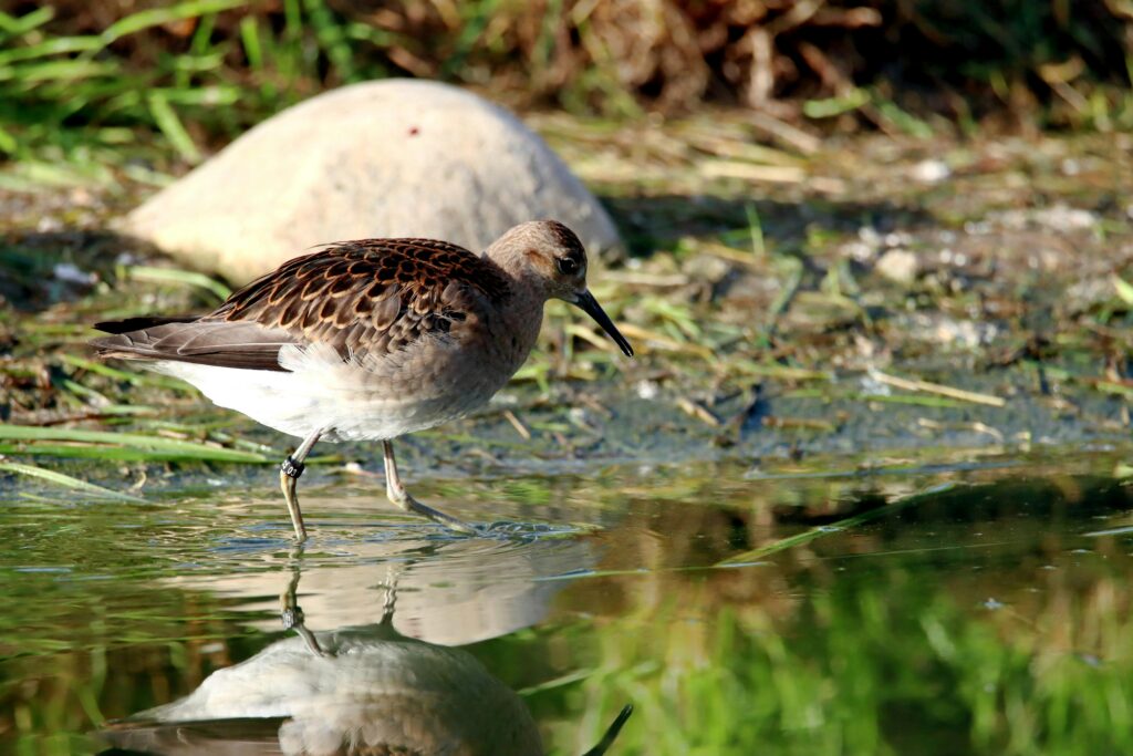
Hydrology also helps explain bird distribution. Rivers, dams, wetlands, and pans support water-associated birds such as herons, egrets, ducks, geese, kingfishers, waders, stilts, darters, and raptors. This is why Nairobi National Park is not only a mammal park with a few wet features. Its water system is one of the foundations of its birding strength.
Decision paragraph: For most visitors trying to understand the park ecologically, the water system matters most in two ways. In the dry season, it helps explain where animals gather. In greener months, it helps explain why birding, wetland scenery, and habitat diversity become especially rewarding.
Status of watering points in Nairobi National Park
Below is a table adapted from KWS’s Management Plan for Nairobi National Park (Page 65), listing the park’s recorded watering points, their type, current desilting status, and the management action indicated for each. It gives a clear overview of how Nairobi National Park’s managed water network is distributed across seasonal dams, permanent dams, and seasonal water pans, and which points require restoration attention.
| No. | Water point | Type | Status | Management action |
|---|---|---|---|---|
| 1 | Embakasi Dam | Seasonal | Desilting Not Required | Not Required |
| 2 | Hyena Dam | Permanent | Desilting Not Required | Not Required |
| 3 | Eland Hollow Dam | Seasonal | Desilting Required | Required |
| 4 | Athi Basin Dam | Permanent | Desilting Not Required | Not Required |
| 5 | Karen C. Primary Dam | Seasonal | Desilting Required | Required |
| 6 | Olmanyi Dam | Seasonal | Desilting Required | Required |
| 7 | Impala Point Dam | Seasonal | Desilting Required | Required |
| 8 | Nagolomon Dam | Permanent | Desilting Required | Required |
| 9 | Kingfisher Dam | Seasonal | Desilting Required | Required |
| 10 | Ruai Dam | Seasonal | Desilting Required | Required |
| 11 | No. 2 Water Pan | Seasonal | Desilting Required | Required |
| 12 | No. 6A Water Pan | Seasonal | Desilting Required | Required |
| 13 | No. 24A Water Pan | Seasonal | Desilting Required | Required |
| 14 | Banda Water Pan | Seasonal | Desilting Required | Required |
| 15 | No. 26D Water Pan | Seasonal | Desilting Required | Require |
A simple reading of the table shows that only Embakasi Dam, Hyena Dam, and Athi Basin Dam are listed as not requiring desilting, while the rest of the park’s recorded seasonal dams and water pans require management attention. That pattern helps explain why hydrology in Nairobi National Park is not just about having water points, but about maintaining them in a condition that keeps them ecologically functional.
The main hydrology threats
The biggest hydrology threat facing Nairobi National Park is not simply drying. It is cumulative ecological degradation across the water system. Wetland quality decline, siltation, polluted inflows, catchment urbanization, southern fragmentation, and climate variability are all interacting pressures. That means Nairobi National Park hydrology should be read as a catchment problem, a wetland-quality problem, and a wildlife-pressure problem at the same time.
1. Wetland quality decline
Wetland decline in Nairobi National Park is about ecological condition, not just water presence. A 2012 Research found that more than 84% of the variation in Hyena and Nagolomon wetland condition was explained by environmental and settlement-linked parameters, with Hyena appearing more polluted than Nagolomon. This is an important distinction for search intent: a dam can still hold water and still be ecologically degraded.
2. Siltation and storage loss
Siltation is reducing the function of dams, pans, and wetlands. This 2021 Study notes that many dams and pans need desilting and that aquatic habitats are already being affected. This turns hydrology into an operational conservation issue, not just a descriptive one.
3. Polluted inflows and catchment pressure
The park’s rivers and wetlands are being shaped by processes far beyond its boundary. As noted in the KWS Management Plan (2020 – 2030), the wider Mbagathi system is influenced by raw sewage, plastics, domestic waste, industrial waste, car-wash runoff, and agricultural effluents. That makes the hydrology issue explicitly catchment-wide, not only a problem of park maintenance inside the fence.
4. Southern fragmentation and water stress
Fragmentation south of the park also increases water pressure inside the park. Ogutu’s Study found that when outside movement space is reduced, more wildlife becomes dependent on fewer in-park water sources. That means hydrology and connectivity are linked. Southern fragmentation is not only a movement problem. It is also a water-demand problem.
5. Climate variability
Climate variability intensifies both wet and dry extremes. Wetter periods increase polluted runoff, overflow, and faster siltation as captured in the same 2021 study catchment-scale study of the Mbagathi–Stony Athi system. Drier periods increase eutrophication risk, shrinking wet habitats, and concentrated wildlife pressure around the most reliable water.
What hydrology conservation should focus on
The most effective hydrology strategy for Nairobi National Park is not simply maintaining the three major dams. It is restoring the full water-point network while managing pollution and wetland quality across the wider catchment.
- The current KWS Management Plan (2020 – 2030) calls for monitoring flow rates, water levels, and water quality in rivers flowing into the park, specifically naming Mbagathi and Mokoyiet. KWS also warns that increasing chemical pollution, sewage, and upstream water-use pressures threaten the park’s conservation values. In other words, NNP’s biodiversity is partly being decided upstream, outside the park boundary.
- KWS states that the Mbagathi River and the many streams draining into it are the main source of water for wildlife in the park. But the same section notes that most of these streams dry up in the dry season, creating water shortage.
- To offset that shortage, 15 watering points were constructed in the park. Yet the latest plan says only 3 are currently serving animals, while the rest are filled with silt and overgrown vegetation. That is a powerful quantitative indicator that hydrological degradation is already constraining ecological function on the ground.
- KWS also notes that these watering points provide microhabitats for water birds, so loss of water infrastructure affects not just mammal distribution, but also avifaunal use of the park. The conservation implication is blunt: degraded water systems reduce biodiversity carrying capacity across multiple taxa at once.
Priority conservation directions
- Restore smaller dams and water pans, not only the major dams
- Treat Hyena and Nagolomon as priority wetland-monitoring sites
- Reduce polluted inflows before they reach the park
- Manage hydrology as a catchment issue, not only a park issue
- Protect wetland vegetation buffers and riparian edges
- Pair desilting with upstream erosion and runoff control
- Reduce road and culvert damage that worsens erosion and sediment delivery
- Protect southern dispersal areas so wildlife demand is not compressed onto a few water sources
- Use climate-adaptive water planning
- Track ecological outcomes, not just whether water is present
This is where the article gains topical authority. It moves from describing rivers and dams to explaining what hydrological decline means, why it matters, and what conservation response the system logically requires.
What this means for understanding Nairobi National Park
Nairobi National Park hydrology is best understood as a distributed ecological support system, not a handful of scenic stops. The Mbagathi River is the park’s main natural river corridor. Mokoyiet adds southern topographic and habitat complexity. Hyena, Nagolomon, and Athi Basin are the three major permanent dam anchors. Around them sits a wider network of seasonal dams and water pans that help spread ecological function across the landscape.
FAQs on Nairobi National Park Hydrology
Does Nairobi National Park have permanent water all year?
Yes. Nairobi National Park has year-round water in its main river system, key wetland areas, and some major dams, although many smaller streams and seasonal pans shrink in dry periods.
What is the main river in Nairobi National Park?
The Mbagathi River is the main river in Nairobi National Park. It forms much of the southern boundary and is the park’s most important riverine wildlife corridor.
Does Nairobi National Park have dams?
Yes. Nairobi National Park has major permanent dams, smaller seasonal dams, and seasonal water pans that support wildlife and wetland habitat.
Which are the main dams in Nairobi National Park?
The three main major dams in Nairobi National Park are Hyena Dam, Nagolomon Dam, and Athi Basin Dam.
Why are dams important in Nairobi National Park?
Dams are important because they support wildlife water access, wetland habitat, birdlife, and dry-season ecological resilience.
Are all the park’s water sources natural?
No. Nairobi National Park has both natural and managed water sources. Rivers are natural, while dams, watering points, and pans are managed features.
Why does hydrology matter in Nairobi National Park?
Hydrology matters because water shapes wildlife distribution, wetland biodiversity, birdlife, habitat quality, and dry-season resilience.
What is the biggest hydrology threat in Nairobi National Park?
The biggest hydrology threat is cumulative ecological degradation caused by pollution, siltation, catchment pressure, fragmentation, and climate variability.