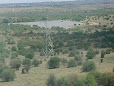
Athi Basin Dam in Nairobi National Park
Athi Basin Dam is a managed water feature in the southern sector of Kenya’s Nairobi National Park. It is a quiet, vehicle-based wildlife and birding stop whose value is evident as one of the park’s wider water system—not as a guaranteed viewing point.
Why Athi Basin Dam matters beyond a photo stop
Athi Basin Dam is valuable because it makes the park’s water-management story visible. Nairobi National Park is a protected area beside a growing city, and its open grasslands, river edges, woodland and seasonal water points do not respond to rain in the same way. A managed dam adds another water-and-habitat node to that mosaic.
The Nairobi Kenya Park’s hydrology guide identifies Athi Basin among the park’s major permanent dams. The attraction page places it in the southern / southeastern plains, near the wider Athi River system and within reach of the Hippo Pool area. That geography helps explain why a stop here can be ecologically useful even when no large animal is visible.
For a visitor, the dam can offer a quieter landscape, birding and a chance to discuss water, grazing pressure and habitat resilience with a guide. For conservation, the important questions are more practical: how much water is available, how well do feeder channels and tracks function, what happens after heavy rain or drought, and how can wildlife use the site without damaging its margins?
Use the wider Nairobi National Park activities guide to balance this water feature with current wildlife reports and the rest of your route.
Athi Basin Dam at a glance
| Question | Practical answer |
|---|---|
| What is Athi Basin Dam? | A managed dam or waterhole inside Nairobi National Park’s southern / southeastern plains. |
| Why is it important? | It contributes water and wetland-edge habitat to the park’s larger hydrological and wildlife network. |
| What might be seen? | Buffalo, zebra, wildebeest, gazelles, eland, giraffe, predators and water-associated birds may occur in the wider area; no sighting is guaranteed. |
| Is it near Hippo Pool? | It is in the same broad southern route context but is a separate water feature and not a substitute for the Hippo Pool experience. |
| Can visitors leave the vehicle? | Remain in the vehicle unless KWS staff expressly designate a safe place or give permission. |
| Half-day or full-day? | Route-dependent; a full day usually gives a guide more flexibility to reach the southern circuits. |
| Best light and activity? | Early morning and late afternoon are usually more comfortable for viewing and photography; current conditions matter more than a fixed promise. |
Specific Helpful Details About Athi Basin Dam
What is Athi Basin Dam?
Athi Basin Dam is a managed water catchment and wildlife-viewing feature inside Nairobi National Park. The attraction page describes it as a southern-plains waterhole, while the park’s hydrology material places Athi Basin among the major permanent dams. In plain language, it is a working part of the park landscape as well as a place a safari vehicle may pause.
The page’s location note identifies Donga and Bonda as seasonal feeder rivers that are dry much of the time. That is useful local context, but it should be read as a guide description rather than a substitute for a current hydrological survey. Rainfall, catchment condition, maintenance and sediment can all change how water reaches and remains in the dam.
What conservation work does a managed dam support?
Water availability
A managed water point can supplement natural sources and help animals move through a broader range of habitat when smaller seasonal pans contract.
Grazing distribution
Water can influence where herbivores spend time, potentially spreading pressure across the landscape rather than concentrating it at one riverbank.
Wetland edges
Shallow margins, open water and nearby vegetation can add feeding and resting opportunities for water-associated birds and other organisms.
Monitoring questions
Water level, silt, shoreline condition, road access and wildlife behaviour are management observations—not details that a tourist photograph can prove.
For the full network of dams, rivers, wetlands and pans, see the Nairobi National Park hydrology guide and the Nairobi National Park Management Plan.
What wildlife might you see?
Athi Basin Dam sits in a broad, open part of the park where wildlife can be widely distributed. The most accurate promise is possibility, not certainty. Your guide should use recent sightings, track condition, season and the rest of the day’s route to decide how long to wait.
- Grazers: zebra, wildebeest, buffalo, Thomson’s and Grant’s gazelles, eland and other herbivores may use the surrounding plains.
- Browsers: giraffe and other browsers may pass through the wider habitat rather than stand at the water’s edge.
- Predators: lions, cheetahs and spotted hyenas occur in Nairobi National Park, but Athi Basin is not a guaranteed predator location.
- Birdlife: herons, egrets, lapwings, ducks, geese, waders, raptors and other water- or grassland-associated birds may use the dam and its margins.
Is Athi Basin good for birdwatching?
It can be, particularly when water levels leave shallow margins and the surrounding grassland is open. Scan the open water, shoreline, nearby trees and the sky; birds may be closer to the dam than larger mammals, but they can also be distant and easily disturbed.
- Carry binoculars even when using a telephoto lens.
- Ask the driver to stop at a respectful distance and keep voices low.
- Use a wider lens for habitat context and a long lens for distant birds.
- Allow time for observation instead of expecting an instant sighting.
For a dedicated experience, compare the Nairobi National Park bird guide with a park birding tour.
Should Athi Basin be included in a half-day safari?
Sometimes, but only when the route makes sense. The southern circuits can take meaningful driving time from some gates, and a named dam should not displace fresh wildlife information simply because it appears on a checklist.
Include Athi Basin when wetland ecology, quiet landscape photography or the southern plains is a priority; the tracks are usable; and the dam fits naturally with other sightings. A full-day safari generally gives a guide more flexibility to combine it with the plains, Hippo Pool area and other water points. A short guided half-day tour lasting no more than 5 hrs can work when the starting gate, available hours and current route align.
Compare nearby water experiences
| Site | Main character | When it may be the better fit |
|---|---|---|
| Athi Basin Dam | Southern-plains dam, open habitat, possible birding and mammal viewing. | You want the Athi Basin / southeastern circuit or a quieter water feature. |
| Hippo Pool | Riverine setting and a distinct visitor experience associated with the Mbagathi system. | You want river habitat or a designated stop where access is permitted. |
| Nagolomon Dam | Permanent managed dam and wetland-focused viewing in another part of the park. | Birding or wetland interpretation fits the route better there. |
| Hyena Dam | Another established water and birding stop used by many park circuits. | Recent sightings, access or time make it the more efficient choice. |
Access and safety
- Stay in the vehicle unless KWS staff explicitly designate a safe place to get out.
- Never approach a shoreline or attempt to walk toward wildlife for a closer photograph.
- Let an experienced driver choose the approach; tracks can change after rains, grading or maintenance.
- Keep voices low, do not feed animals and follow park rules and ranger instructions.
- Check the visiting guide, gate information and health and safety advice before departure.
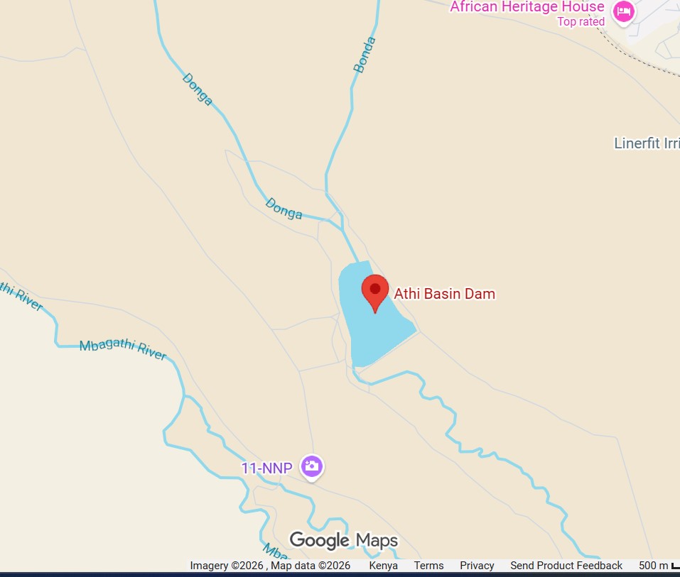
Athi Basin Dam map and coordinates
The attraction is inside Nairobi National Park’s southern / southeastern sector, within the park’s internal game-drive network. The map pin is useful for orientation, but it does not replace current KWS directions, gate advice or a guide’s route decision.

Understand the dam as part of a living water system
Athi Basin Dam is not an isolated attraction. It sits within the same protected landscape that links seasonal feeder channels, permanent dams, the Mbagathi and Athi river systems, open grassland and wildlife corridors. Its conservation value therefore depends on connections: water quality, catchment condition, vegetation, access management and the ability of animals to move between habitats.
Water can make wildlife viewing easier in a dry period, but concentrating animals at one point can also increase grazing pressure, trampling and bank erosion. Responsible management means monitoring the feature, protecting its margins and changing routes when conditions require it. A visitor’s best contribution is simple: remain on designated tracks, keep distance, avoid noise and follow KWS guidance.
Continue with the Nairobi National Park conservation guide and the management-plan overview.
Athi Basin Dam FAQs
Where is Athi Basin Dam in Nairobi National Park?
It is in the park’s southern / southeastern plains, within the internal game-drive network and in the wider route context of the Athi River system and Hippo Pool. Use the coordinate pin above for orientation, then follow current KWS or guide directions.
Is Athi Basin Dam the same as Hippo Pool?
No. They are separate water features. They can be considered within a broad southern route, but Hippo Pool is a riverine experience while Athi Basin is a managed dam and waterhole.
Is Athi Basin Dam natural or artificial?
It is described as a managed dam or water catchment rather than a natural lake. Its wildlife value comes from how the managed water feature interacts with the surrounding grassland, channels and wider park hydrology.
What wildlife can I see at Athi Basin Dam?
Buffalo, zebra, wildebeest, gazelles, eland, giraffe, predators and water-associated birds may occur in the wider area. Sightings are never guaranteed at the dam and vary with season, weather, water level and recent movement.
Can I get out of the safari vehicle?
Remain in the vehicle unless KWS staff explicitly designate a safe area or give permission. Do not approach the water or wildlife for photographs.
What is the best time to visit?
Early morning and late afternoon usually offer the most comfortable light and activity. Drier periods can make water points more relevant, while post-rain periods can bring greener scenery and different birding conditions. Your guide should adjust the route to the day’s reality.
Is Athi Basin Dam suitable for a half-day tour?
It can be, but only when it fits efficiently from your gate and the route. Because southern circuits may require longer driving, a full-day safari normally provides more flexibility to include the dam alongside other habitats and sightings.
What coordinates should I use?
The plotted point used in this guide is latitude −1.412585 and longitude 36.9291789, with the Plus Code HWPH+XM7. Treat this as a map reference; park-track access and on-ground directions can change.
Athi Basin Dam is a quiet lesson in park resilience
Athi Basin Dam rewards visitors who are curious about how Nairobi National Park works, not only those collecting a fixed list of animal sightings. Its water, open plains and route position make it a useful place to talk about habitat, seasonal change and the careful balance between wildlife access and conservation protection.
Ask your guide to consider it when current conditions, your interests and the day’s route align. Stay flexible, observe from the vehicle and let the park’s wider ecological story—not a guaranteed photograph—define the stop.
Planning a Nairobi National Park safari?
Share your date, pickup location, group size and whether the southern plains, birding or Athi Basin is a priority. You can also start with nairobi nature tours.